
VIP member
Trimble GEO 7 Series Handheld GPS
Product Introduction: The Trimble Geo 7 series can handle all data collection tasks at any time, achieving true high productivity. No matter what chal
Product details
Product Introduction
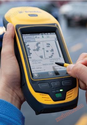
Image display


Capable of handling all data collection tasks at any time
Using Trimble ® The Geo 7 series can achieve true high productivity. No matter what challenges you encounter in your work.
Overcoming environmental obstacles and achieving field achievements.
The Geo 7X handheld provides two powerful technological changes that enable you to maintain high efficiency even in harsh working conditions.
When unable to reach the target area, the intelligent surveying instrument will be able to switch to Trimble Flightwave ™ Technology. The workflow of Flightwave has been enabled, and through Trimble data acquisition software, it is easy to integrate offset measurement data directly from the Geo 7 ranging module. Users only need to point the instrument at the target and aim it accurately to obtain positioning data. Whether in dangerous conditions or facing various challenges, they can complete tasks that were previously impossible and save time every day.
When encountering dense sky cover that causes weak satellite signals, TrimbleFloodlight ™ Shadow elimination technology will ensure that you can continue working.
Trimble Flightwave remote positioning technology
Conveniently and efficiently collect asset data through remote measurement
Trimble Floodlight satellite shadow elimination technology
In harsh GNSS environments, it is possible to measure more positions with higher accuracy
Terminal to terminal data collection scheme
By being compatible with existing and planned GNSS constellations, Geo7X can provide reliable GNSS tracking intelligence from now until the future, maximizing productivity.
Geo 7X is compatible with various Trimble GIS field and office software, providing you with flexible end-to-end data collection solutions and workflow options. From Trimble TerraSync, which has undergone on-site inspection ™ And positions ™ Software, to Trimble TerraFlex ™ Software customizable data collection workflow.
Product Features
Product Features
Support satellite systems such as Beidou/GPS/GLONASS/ALILEO to achieve efficient GNSS data acquisition
■ Floodlight satellite shadow elimination technology, adapted to harsher collection environments
Flightwave remote positioning technology enables offset measurement
■ Integrate Bluetooth WIFI、 Combining a digital camera and a 3.5G communication module to handle all acquisition tasks at any time
Technical Specifications
Technical Specifications
physical dimensions
Geo 7X handheld device: 234mm × 99mm × 56mm
Geo 7X handheld device: 963g
Geo 7X handheld device with rangefinder 1080g
GNSS, Direction, distance
GNSS sensor: L1/L2 GNSS receiver and antenna
Chipset: 220 channel Trimble Maxwell ™ six
System: GPS, GLONASS, Galileo, Beidou QZSS
SBAS:WAAS、EGNOS、MSAS、GAGAN
SBAS+: Yes
Floodlight: Yes
Receiver protocols: NMEA, TSIP2
Update rate: 1Hz
First fixed time:<45 seconds (generally)
Real time correction protocol: RTCM2.x/RTCM3.x/CMRx
Real time centimeter mode accuracy
Level: 1cm+1ppm HRMS
垂直: 1.5cm+2ppm VRMS
Post processing centimeter mode accuracy
Level: 1cm+1ppm HRMS
垂直: 1.5cm+2ppm VRMS
H-Star ™ Accuracy: 10 cm+1 ppm HRMS
Code accuracy (real-time): 75 cm+1 ppm HRMS
Code accuracy (post-processing): 50 cm+1 ppm HRMS
SBAS accuracy: generally sub meter level
Directional sensors: 3-axis gyroscope, magnetometer, accelerometer
Heading accuracy: 1.5 °
Tilt angle accuracy: 0.5 °
Tilt accuracy: 0.5 °
Distance sensor: laser rangefinder module
Communication protocol: owned by NMEA or Trimble
Passive range: up to 120m
Reflection range: up to 120m
Accuracy: 0.05m
Range accuracy: 0.01m
Network and wireless connectivity
GSM/GPRS/EDGE: 850 / 900 / 1800 / 1900 MHz
UMTS/HSPA+ :800 / 850 / 900 / 1900 / 2100 MHz
CDMA/EV-DO Rev. A: 800/1900 MHz (Verizon certified)
Wi-Fi:802 .11b/g
Power supply and battery
Type: Rechargeable and removable lithium batteries
Capacity: 11.1V 2500 mAH
Charging time:<4 hours (generally)
Real time DGNSS usage (by integrating 3G/3.5G): up to 7 hours
Real time DGNSS usage (via Bluetooth): up to 9.5 hours
Non GNSS usage: up to 24 hours
Standby: up to 50 days
System CPU, memory, and camera
CPU:Texas Instruments DM3730 1 GHz + GPU
Memory: 4GB user memory+SD slot (up to 32GB), 256 MB RAM
Camera: 5 MP
Display screen and touch panel
Display screen: 4.2 "VGA (640 x 480) LED semi reflective
Touch panel: resistive touch panel with polarizing filter
Brightness: 280 cd/m2
operating system
Syncing with the computer requires the installation of Windows 7, Windows Vista, or Windows XP Home or Professional (with Service Pack 3 or higher). Some field applications and services need mobile Internet access support.
Environmental use
Operating ambient temperature: -20 ° C to 60 ° C
Storage temperature: -30 ° C to 70 ° C
Relative humidity: 95% non condensing
Maximum working height: 9000 meters
Maximum storage height: 12000 meters
Waterproof/dustproof: IP65
Functional Impact: MIL-STD 810G Method 516. 6 Procedure I
Falling: 1.22 meters
振动: MIL-STD 810 G Method 514 .6 Procedure I
Application Industry
Application Industry
Land: land survey, land change investigation, remote sensing verification, mining investigation, etc
Environment: pollution source location, pollution area investigation, etc
Petroleum Geology: Collection of Geological Boundary Data, Collection and Inspection of Petroleum Pipelines, Geological Mapping, Updating of Digital Geological Maps, etc
Forestry: Forestry resource management, resource investigation, afforestation planning, ecological monitoring, forest fire prevention, pest control, etc
Agriculture: Basic farmland survey, soil erosion survey, precision agriculture, agricultural disease monitoring, etc
Electricity: power inspection, power facility positioning, etc
Gas: Pipeline inspection, pipeline positioning, component investigation, gas GIS, etc
In addition, GPS is widely used in more than 40 industries such as railway, communication, ocean, transportation, scientific research, tourism, civil affairs, insurance, taxation, etc.
Image display
Online inquiry
-
Contacts
-
Company
-
Telephone
-
Email
-
WeChat
-
Verification Code
-
Message Content
-