
VIP member

UWB personnel positioning solution of Hangzhou Tengdong Information Technology Co., Ltd
1、 Introduction to UWB Solution of Hangzhou Tengdong Information Technology Co., Ltd. UWB positioning technology is a high-precision positioning techn
Product details
1、 Introduction to UWB Solution of Hangzhou Tengdong Information Technology Co., Ltd
UWB positioning technology is a high-precision positioning technology aimed at various industrial fields, with the characteristics of high positioning accuracy (up to 10cm, average 20cm), strong real-time performance (granularity can reach 100ms), and strong anti-interference ability. Compared to popular WIFI positioning and Bluetooth positioning technologies. UWB positioning technology is the most cost-effective solution. It is the best choice for industrial applications.
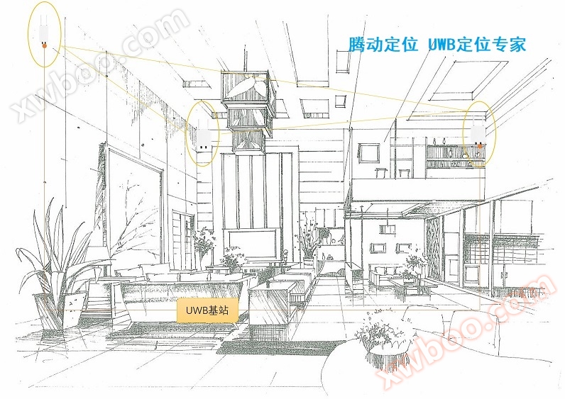
The UWB personnel positioning solution of Hangzhou Tengdong Information Technology Co., Ltd. adopts a stable industrial grade solution, supplemented by continuously optimized positioning algorithms, with high positioning accuracy, good boundary effects, and stable products. Widely used in various fields of production safety control and optimization of production methods, it has received unanimous praise from downstream application manufacturers.
2、 Solution
The entire UWB personnel positioning system is mainly aimed at obtaining three-dimensional position coordinate information of people, production materials, and production tools in the production process. As a technical link of Industry 4.0, it visualizes various basic information of industrial production in four-dimensional space, laying a solid foundation for further big data integration and iteration. The UWB positioning system of Tengdong Information consists of several components: UWB positioning base station, UWB positioning tag, UWB positioning engine, and user management platform.
UWB positioning base station: The positioning and calculation of UWB tags are mainly carried out through positioning base stations and positioning tags, and the relative position is calculated through time difference algorithm
UWB positioning tag: emits pulse UWB signals, the base station receives the signals, and both parties jointly calculate the location information of the tag.
UWB positioning engine: By uniformly solving the data uploaded by multiple base stations, the relative coordinates of the tags are calculated
User management platform: Manage the entire UWB network and provide users with various positioning functions such as human-machine interface and GIS display.

2.1 System Functions
2.1.1 Real time personnel GIS map dynamic display
Can import CAD maps of positioning areas and generate digital vector maps
Query and display the number of people, distribution, and identity of a location at any time.
Query the current actual location and activity trajectory of one or more individuals.
Recording a series of information such as the arrival/departure time and total working time of personnel at any location can supervise and implement whether important inspection personnel conduct on-site inspections on time and at the designated time, or carry out various data detection and processing, fundamentally avoiding accidents caused by human factors.
2.1.2 Attendance statistics of personnel
It is possible to conduct statistics on personnel in the positioning area, achieve attendance records for personnel in the positioning area, establish and print various information reports on personnel entering and leaving the positioning area (such as unit time reports, attendance monthly reports, overtime reports, absence reports, etc.), and facilitate the query and management of management personnel.
2.1.3 Information Multi point Sharing
The positioning platform and positioning base station can be networked and operated in a local area network manner, enabling all terminals on the network to achieve multi-point information sharing within their usage permissions. This allows multiple departments and leaders of mines to share monitoring information, system comprehensive analysis information, and query various data reports at different locations simultaneously.
2.1.4 Electronic fence alarm function
For designated electronic fence restricted areas, if unauthorized personnel enter, a real-time sound alarm will be triggered, and the number and identity of personnel entering the restricted area, as well as their trajectories, will be displayed.
2.1.5 Post disaster emergency information
Once various accidents occur, the monitoring center can immediately display the number of tagged personnel, personnel information, personnel location, and other information at the accident site, greatly improving the efficiency and effectiveness of emergency rescue.
2.1.6 Label emergency function
When the UWB tag loses contact with the positioning base station, it can still work independently and automatically store personnel monitoring data.
2.2 System Performance Characteristics
2.2.1 Powerful system processing capability
Using TDOA positioning algorithm to optimize the system's data processing capability;
Highly automated, with automatic monitoring, statistics, and analysis of information, the entire process does not require human intervention;
Geographic information display and query system based on GIS technology;
● Comprehensive data analysis capabilities;
2.2.2 Excellent recognition performance
High recognition reliability, 100% front-end recognition rate;
● Long recognition distance (ground recognition distance can reach 100 meters);
● Extremely high conflict prevention (each detection point can identify up to 10000 personnel simultaneously);
● High recognition stability;
● Fast recognition speed
High positioning accuracy, reaching 10cm
2.2.3 On site advantages
Environmental adaptability: high anti-interference ability, no special requirements for interference sources and perimeter environment;
● Installation convenience: The integrated structure design of the positioning base station adopts POE power supply;
● Operational reliability: The internal circuit is highly integrated, minimizing device failure rates.
2.2.4 Electrical characteristics
Ultra low power consumption, wireless tags can work continuously for 3 years without replacing the battery;
● Convenience and safety, positioning tags do not require external mining lamp power supply, and have a long standby time;
No radiation, no impact on human body and environment, safer and healthier
3、 Applicable fields
The positioning solution of Hangzhou Tengdong Information Technology Co., Ltd. is widely used in various fields of production safety. In more mature application areas, there are:
Power industry: referencePositioning Plan for Power Station Personnel
Robot industry: referenceAGV Robot Positioning Solution
Urban pipe gallery: referenceUnderground Pipe Gallery Positioning Plan
Warehouse Logistics: ReferenceWarehouse Logistics Positioning Plan
Petroleum and Petrochemicals: Reference《石油石化定位方案》
Prison Detention Center: ReferencePrison Positioning Plan
Forklift industry: referenceForklift Logistics Positioning Plan
Online inquiry
-
Contacts
-
Company
-
Telephone
-
Email
-
WeChat
-
Verification Code
-
Message Content
-